Climate Change Increases New Zealand Landslides, Tech Mitigates Risk
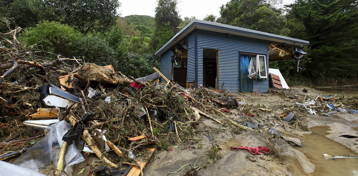
Landslide risk in New Zealand is rising as extreme rainfall events grow more frequent and intense, driven by climate change. Steep terrain, weak sedimentary rocks, and loss of forest cover concentrate exposure, producing an estimated NZ$250-300 million in annual damage. Practitioners are now combining satellite remote sensing, InSAR, high-resolution LiDAR, weather radar, and AI to map susceptibility, detect slope failures rapidly, and convert messy reports into structured datasets. Field-proven pipelines from international cases show automated models can detect thousands of landslides within hours of imagery acquisition. New Zealand programmes, university labs, and national hazard agencies are piloting these tools to build national inventories, improve early warning, and prioritize mitigation investment.
What happened
Climate change is increasing the frequency and intensity of heavy rainfall in New Zealand, pushing more slopes toward failure. New Zealand already records high landslide exposure because of its steep topography and weak sedimentary rocks; landslides cost about NZ$250-300 million per year. Practitioners and researchers are deploying a stack of remote sensing and AI tools to map susceptibility, detect post-event failures rapidly, and turn scattered observational records into structured datasets for planning and response.
Technical details
Operational workflows combine multiple Earth observation modalities and AI components. Key elements include:
- •High-resolution optical and synthetic aperture radar imagery for change detection and rapid mapping
- •InSAR time series to track slow ground deformation that precedes failures
- •LiDAR digital elevation models for slope geometry, curvature, and volume estimates
- •Weather radar and satellite rainfall products to establish trigger thresholds and event attribution
- •AI models for segmentation and object detection to automate landslide delineation and classification
Recent technical demonstrations matter. In a rapid-response study from Taiwan, AI combined with EO imagery identified 7090 landslide events covering more than 75 km2 within approximately 3 hours of imagery acquisition, showing near-real-time inventories are feasible. At home, programmes like CRISiSLab at Massey University are funding interns to build AI-ready datasets by extracting structured facts from unstructured flood and landslide reports using large language models and to train deep learning models on curated remote-sensing labels.
Practitioner-level considerations include pre-processing steps such as co-registration, atmospheric and terrain correction, cloud masking for optical data, and temporal stacking for InSAR. Label scarcity and domain shift remain practical constraints; transfer learning, semi-supervised approaches, and synthetic augmentation help bridge gaps. False positives arise from vegetation change, burn scars, and seasonal soil moisture-operational systems must integrate multi-sensor corroboration and contextual layers like land cover and infrastructure maps.
Context and significance
This work sits at the intersection of climate impact science, remote sensing, and applied machine learning. As extreme rainfall events become more common under higher emissions scenarios, hazard managers need nationally consistent susceptibility maps and rapid inventories to prioritize mitigation and allocate resources. Automated EO+AI pipelines transform how agencies can: update exposure databases, validate engineering designs, and run scenario-based planning at scale. The Taiwan research shows the method scales to thousands of features; New Zealand benefits from national initiatives, improved radar and satellite coverage, and growing local capability in AI-for-hazards.
However, practical adoption requires investments in labelled datasets, national LiDAR coverage, processing infrastructure, standardised data formats, and training for council and emergency managers. Governance questions include data sharing, verification protocols for automated detections, and integration with existing warning systems.
What to watch
Track operational pilots that fuse InSAR, radar rainfall, and automated mapping into near-real-time alerts for councils and emergency services, alongside investments in national LiDAR and labelled training datasets. The success metrics will be reduction in detection-to-action time, lower false positive rates, and demonstrable improvements in evacuation and infrastructure planning outcomes.
Key Points
- 1Intensifying extreme rainfall from climate change increases landslide frequency, moving more slopes closer to failure and raising community exposure.
- 2Combining InSAR, LiDAR, weather radar, and AI enables near-real-time landslide inventories, shrinking detection time from weeks to hours.
- 3Operational impact depends on labelled datasets, national LiDAR coverage, data standards, and integrating automated outputs into decision workflows.
Scoring Rationale
This story is important for practitioners because it describes practical, deployable combinations of remote sensing and AI that materially improve hazard mapping and response. It is not a frontier-model breakthrough, but represents notable operational progress with direct policy and engineering implications. Recent publication timing reduces the score slightly.
Sources
Public references used for this report.
Practice with real Ad Tech data
90 SQL & Python problems · 15 industry datasets
250 free problems · No credit card
See all Ad Tech problems