Policy & Ethicsgenerative aisatellite imageryosintdisinformation
Generative AI Produces Fake Satellite Imagery
8.1
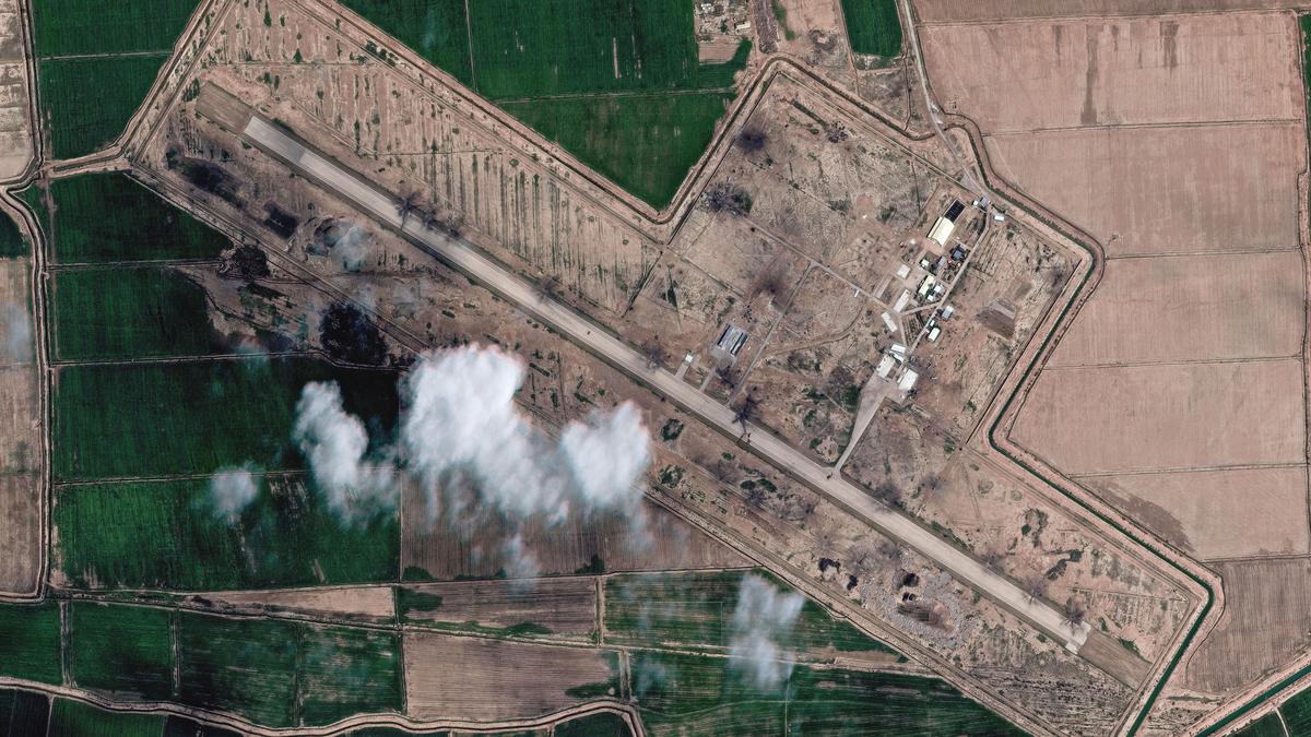
AFP reports that Tehran Times posted an AI-manipulated satellite image this month claiming "completely destroyed" US radar at a Qatar base, but researchers traced it to a Google Earth image of a Bahrain base. The incident, detected via visual artifacts and a SynthID watermark, illustrates how generative AI enables convincing fabricated imagery that spread millions of views and undermines OSINT and security assessments during the US-Israeli war with Iran.
Key Points
- 1Highlights fabricated satellite images: Tehran Times posted an AI-manipulated Google Earth photo claiming destroyed US base.
- 2Warns state actors exploit generative AI to mass-produce convincing imagery, revealed by artifacts and SynthID detection.
- 3Impairs OSINT trust and verification workflows, risking misinformed public opinion, market moves, and security decisions.
Scoring Rationale
Strong credibility and wide security impact drive score; limited novelty and mainly descriptive reporting constrain breakthrough potential.
Practice interview problems based on real data
1,625 SQL & Python problems across 15 industry datasets — the exact type of data you work with.
Try 250 free problems
