AI Maps Arctic Permafrost Thaw From Satellite Images
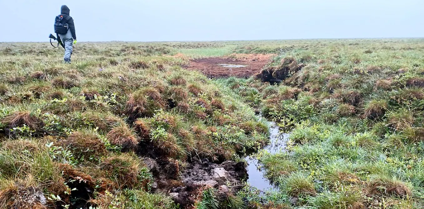
On August 26, 2026, researchers working on the Permafrost Discovery Gateway described using satellite imagery and AI to map Arctic permafrost thaw in near real time. The project uses thaw-related landscape changes, including rapidly draining lakes, as observable indicators, and Woodwell Climate Research Center received a $5 million Google.org grant in 2023 to expand the open-access resource.
Researchers working on the Permafrost Discovery Gateway are using satellite imagery and AI to identify and map Arctic permafrost thaw in near real time, according to an August 26, 2026, article in The Conversation by Anna Liljedahl and Ingmar Nitze. The authors describe the abrupt drainage of lakes as one visible indicator of permafrost change, alongside ground collapse that can damage buildings, roads, and pipes.
Permafrost is ground that has remained at or below 0 degrees C for at least two consecutive years. The Conversation reports that much of Alaska's permafrost contains ice, and that thawing ice can cause the overlying ground to sink. It also notes that current maps of thaw impacts are often not sufficiently current to support community planning in rapidly changing Arctic landscapes.
From imagery to thaw maps
Woodwell Climate Research Center announced in July 2023 that it had received $5 million from Google.org to develop an expanded, open-access Permafrost Discovery Gateway. According to Woodwell, the project is intended to combine satellite data and AI to speed analysis of thaw-related datasets and identify patterns across the Arctic.
UConn's 2023 account of the grant identified remote-sensing researcher Chandi Witharana as part of the international team. Witharana said the work would combine sub-meter commercial satellite imagery with AI to produce pan-Arctic geospatial map products covering permafrost landforms, thaw disturbances, and human-built infrastructure.
Liljedahl, Woodwell's project lead, said in the 2023 announcement that rapid tracking had been constrained by both remote-sensing technology and the pace of Arctic landscape change. Google.org also committed technical support through a pro bono program, Woodwell reported.
Why the workflow matters
The reported technical challenge is analyzing satellite imagery and thaw datasets across broad Arctic areas. The project's reported use of AI is intended to streamline that analysis and help identify patterns and trends in permafrost change.
For geospatial ML practitioners, this work illustrates a recurring remote-sensing pattern: models can make monitoring programs more operationally useful when paired with high-resolution imagery, historical records, and domain-defined indicators such as lake drainage and ground subsidence. The reliability of such systems depends on validation across regions, seasons, sensors, and land-cover conditions, particularly when their outputs inform infrastructure and climate-risk decisions.
Key Points
- 1The Permafrost Discovery Gateway applies AI to satellite imagery, aiming to convert visible thaw disturbances into more timely Arctic geospatial maps.
- 2Rapidly draining lakes and ground collapse provide observable thaw indicators, connecting computer-vision outputs to permafrost processes and infrastructure risk.
- 3Comparable Earth-observation systems depend on robust validation across seasons, sensors, and geographies before supporting high-consequence planning decisions.
Scoring Rationale
The project demonstrates a concrete application of AI and high-resolution remote sensing to climate-risk monitoring across the Arctic. It is relevant to geospatial ML and environmental-data practitioners, though the underlying grant and platform expansion were announced in 2023 rather than being a newly released model or tool.
Sources
Primary source and supporting public references used for this report.
Practice interview problems based on real data
1,625 SQL & Python problems across 15 industry datasets — the exact type of data you work with.
Try 250 free problems